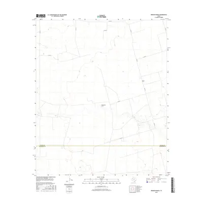
2016 Map of Brinson Ranch
USGS Topo · Published 2016About this map
The high plains of West Texas are defined here by the open ranching country along the Gaines Co Andrews Co line. Central to this landscape is Monument Draw, a seasonal drainage feature that meanders through the arid terrain, illustrating the importance of natural watercourses in an area otherwise dominated by a rigid grid of county roads. The settlement pattern is sparse, centered on the Brinson Ranch, which serves as a significant local landmark. This 2016 survey documents the modern infrastructure of the Permian Basin fringe, where long stretches of road like Nadine Rd and Co Rd 331 connect isolated agricultural and industrial interests. The map provides a clear look at the relationship between the natural topography of the draw and the geometric parceling of Texas ranch land.
Find a feature on this map
13 named features on this map. Tap any name to fly to it.
Don’t see what you’re looking for? This feature index may not catch every label — zoom into the map to look around manually.
Map Details
Editions of this 2016 Brinson Ranch Map
This is the sole edition of this map. No revisions or reprints were ever made.
Other maps of this area

1954 · Hobbs
USGS Topo · 1:250,000

1958 · Hobbs
USGS Topo · 1:250,000

1969 · Hobbs East
USGS Topo · 1:24,000

1969 · Hobbs SE
USGS Topo · 1:24,000

1969 · Eunice NE
USGS Topo · 1:24,000

1971 · Paynes Corner
USGS Topo · 1:24,000

1971 · Brinson Ranch
USGS Topo · 1:24,000

1971 · Paynes Corner SE
USGS Topo · 1:24,000

1971 · Frankel City
USGS Topo · 1:24,000

1971 · Jumbo Hill
USGS Topo · 1:24,000