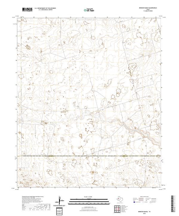
2022 Map of Brinson Ranch
USGS Topo · Published 2022About this map
Monument Draw carves a subtle path across this arid landscape, defining the topography of the High Plains near the southern edge of Gaines County. This recent survey illustrates the modern rural infrastructure at the boundary between Gaines Co and Andrews Co, where a network of county roads like Co Rd 341 and Co Rd 318 provides access to large ranch holdings. The landscape is characterized by numerous small depressions and basins, typical of this region's geomorphology. The layout of roads such as Nadine Rd and Co Rd 327 reflects a long-established grid system used to navigate and manage this expansive territory. This map captures the intersection of natural drainage features and the structured human organization of the Texas Panhandle, serving as a reliable reference for understanding current land divisions and topographical elevations in the Brinson Ranch area.
Find a feature on this map
12 named features on this map. Tap any name to fly to it.
Don’t see what you’re looking for? This feature index may not catch every label — zoom into the map to look around manually.
Map Details
Editions of this 2022 Brinson Ranch Map
This is the sole edition of this map. No revisions or reprints were ever made.
Other maps of this area

1954 · Hobbs
USGS Topo · 1:250,000

1958 · Hobbs
USGS Topo · 1:250,000

1969 · Hobbs East
USGS Topo · 1:24,000

1969 · Hobbs SE
USGS Topo · 1:24,000

1969 · Eunice NE
USGS Topo · 1:24,000

1971 · Paynes Corner
USGS Topo · 1:24,000

1971 · Brinson Ranch
USGS Topo · 1:24,000

1971 · Paynes Corner SE
USGS Topo · 1:24,000

1971 · Frankel City
USGS Topo · 1:24,000

1971 · Jumbo Hill
USGS Topo · 1:24,000