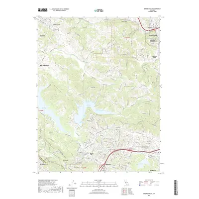
2018 Map of Briones Valley
USGS Topo · Published 2018About this map
John Muir National Historic Site and Mt Wanda anchor the northeastern corner of this 2018 landscape, marking the transition between the urbanized corridor of Martinez and the protected hills. The terrain is defined by the high ridges of Sobrante Ridge and San Pablo Ridge, which flank the extensive San Pablo Reservoir and Briones Reservoir. These water bodies are fed by creeks like Bear Creek and San Pablo Creek, which carve through the central Briones Valley and into Sindicich Lagoons.
Find a feature on this map
210 named features on this map. Tap any name to fly to it.
Don’t see what you’re looking for? This feature index may not catch every label — zoom into the map to look around manually.
Map Details
Editions of this 2018 Briones Valley Map
This is the sole edition of this map. No revisions or reprints were ever made.
Other maps of this area

1895 · San Francisco
USGS Topo · 1:62,500

1896 · Carquinez Strait
USGS Topo · 1:62,500

1897 · Concord
USGS Topo · 1:62,500

1898 · Karquines
USGS Topo · 1:62,500

1899 · San Francisco
USGS Topo · 1:62,500

1901 · Karquines
USGS Topo · 1:62,500

1902 · Napa
USGS Topo · 1:125,000

1915 · Concord
USGS Topo · 1:62,500

1915 · San Francisco
USGS Topo · 1:62,500

1916 · Mare Island
USGS Topo · 1:62,500