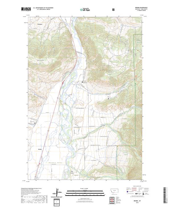
2024 Map of Brisbin
USGS Topo · Published 2024About this map
Yellowstone River corridors and high alpine transitions define this part of Park County, where the valley floor meets the eastern foothills of the Gallatin National Forest. The settlement of Brisbin sits as a primary marker along the western bank, while the broader Paradise Valley extends southward toward Pine Creek. The landscape is etched with irrigation networks like the Livingston Ditch and Spring Creek Ditch, reflecting the long-standing agricultural dependence on river-fed water. Further east, the terrain rises sharply into the Absaroka-Beartooth Wilderness, accessed by trails winding along the South Fork Deep Creek. Local family history and early settlement patterns are preserved through features like the Strickland Cem and Sykes Cem, alongside the historic route of the Old Yellowstone Trail North Rd, which traces the ancestral path through the mountain pass.
Find a feature on this map
68 named features on this map. Tap any name to fly to it.
Don’t see what you’re looking for? This feature index may not catch every label — zoom into the map to look around manually.
Map Details
Editions of this 2024 Brisbin Map
This is the sole edition of this map. No revisions or reprints were ever made.
Other maps of this area

1891 · Livingston
USGS Topo · 1:250,000

1893 · Livingston
USGS Topo · 1:250,000

1940 · Mt. Cowen
USGS Topo · 1:62,500

1943 · Mt Cowen
USGS Topo · 1:62,500

1947 · Bozeman
USGS Topo · 1:250,000

1948 · Bozeman
USGS Topo · 1:250,000

1951 · Brisbin
USGS Topo · 1:24,000

1951 · Hoppers
USGS Topo · 1:24,000

1951 · Livingston Peak
USGS Topo · 1:24,000

1951 · Chimney Rock
USGS Topo · 1:24,000