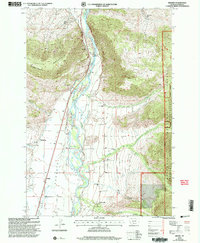
2000 Map of Brisbin
USGS Topo · Published 2005About this map
Paradise Valley is defined by the braided path of the Yellowstone River, which anchors the central landscape of this Montana survey. The settlement pattern reflects a deeply rooted rural community, evidenced by a dense distribution of local schools such as Richland Sch, Suce Creek Sch, and Deep Creek Sch. The river's influence is seen in the infrastructure at Carter Bridge and the Gaging Sta, while the Park Branch Canal and various irrigation ditches like the Ditch near Pine Creek indicate the agricultural heritage of the valley floor.
Find a feature on this map
35 named features on this map. Tap any name to fly to it.
Don’t see what you’re looking for? This feature index may not catch every label — zoom into the map to look around manually.
Map Details
Editions of this 2000 Brisbin Map
This is the sole edition of this map. No revisions or reprints were ever made.
Other maps of this area

1891 · Livingston
USGS Topo · 1:250,000

1893 · Livingston
USGS Topo · 1:250,000

1940 · Mt. Cowen
USGS Topo · 1:62,500

1943 · Mt Cowen
USGS Topo · 1:62,500

1947 · Bozeman
USGS Topo · 1:250,000

1948 · Bozeman
USGS Topo · 1:250,000

1951 · Brisbin
USGS Topo · 1:24,000

1951 · Hoppers
USGS Topo · 1:24,000

1951 · Livingston Peak
USGS Topo · 1:24,000

1951 · Chimney Rock
USGS Topo · 1:24,000