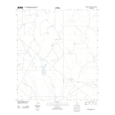
2013 Map of Briscoe Ranch
USGS Topo · Published 2013About this map
Briscoe Ranch serves as the focal point of this South Texas landscape, situated along the La Salle McMullen Co Line. The territory is defined by an intricate network of water management features, reflecting the necessities of ranching in this semi-arid environment. Numerous stock tanks with Spanish and family names, such as Tanque Las Tres-Puertas, Tanque-Noche Triste, and Alexander Lake Number 2, are distributed across the terrain. These artificial water bodies, alongside drainages like Elm Cr and Guadalupe Cr, support the local livestock industry. Evidence of energy extraction is also visible near Oil Wells Tank, while local transit is facilitated by Martin Rd. The naming conventions of features like Tanque Mula and Pozo Tank provide a linguistic window into the cultural heritage of McMullen County.
Find a feature on this map
31 named features on this map. Tap any name to fly to it.
Don’t see what you’re looking for? This feature index may not catch every label — zoom into the map to look around manually.
Map Details
Editions of this 2013 Briscoe Ranch Map
This is the sole edition of this map. No revisions or reprints were ever made.
Other maps of this area

1930 · Tilden
USGS Topo · 1:62,500

1937 · Loma Alta
USGS Topo · 1:62,500

1942 · Fowlerton
USGS Topo · 1:62,500

1942 · Tilden
USGS Topo · 1:62,500

1953 · Crystal City
USGS Topo · 1:250,000

1955 · Crystal City
USGS Topo · 1:250,000

1956 · Piedra Creek
USGS Topo · 1:62,500

1956 · Fowlerton
USGS Topo · 1:62,500

1961 · Crystal City
USGS Topo · 1:250,000

1968 · Crystal City
USGS Topo · 1:250,000