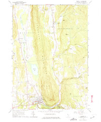
1963 Map of Bristol
USGS Topo · Published 1974About this map
Bristol serves as the focal point of this Vermont landscape, situated where the New Haven River flows out from the Green Mountain National Forest. The town's grid is dense with local history, featuring the Mountain Street Sch and several prominent burial grounds, including Greenwood Cem and Mt St Joseph Cem. Stretching northward, the Hogback Mountains create a significant north-south barrier between the drainages of Pond Brook and Lewis Creek.
Find a feature on this map
48 named features on this map. Tap any name to fly to it.
Don’t see what you’re looking for? This feature index may not catch every label — zoom into the map to look around manually.
Map Details
Editions of this 1963 Bristol Map
3 editions found
Other maps of this area

1903 · Middlebury
USGS Topo · 1:62,500

1905 · Middlebury
USGS Topo · 1:62,500

1906 · Burlington
USGS Topo · 1:62,500

1919 · Burlington
USGS Topo · 1:62,500

1919 · Lincoln Mountain
USGS Topo · 1:62,500

1920 · Lincoln Mountain
USGS Topo · 1:48,000

1920 · Middlebury
USGS Topo · 1:62,500

1921 · Richmond
USGS Topo · 1:48,000

1921 · Lincoln Mountain
USGS Topo · 1:62,500

1924 · Camels Hump
USGS Topo · 1:62,500