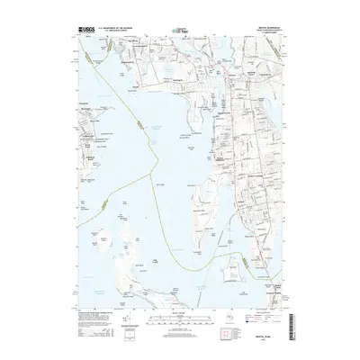
2015 Map of Bristol
USGS Topo · Published 2015About this map
Bristol and its maritime neighbors along the Narragansett Bay waterways are shown here during a period of modern stability. The landscape is defined by its deep coastal indentations, from the Providence River and Bullock Point Reach to the sheltered Bristol Harbor. Dense residential patterns characterize Barrington, West Barrington, and Warren, while the south end of the peninsula features the academic campus of Roger Williams Univ and the extensive grounds of Colt State Park along Mill Gut. Numerous legacy sites for genealogists are preserved in the mapping, including several large burial sites such as Princes Hill Cem and Juniper Hill Cem. The transportation network is anchored by the Mount Hope Bridge connecting Bristol Township to the southern islands, alongside established neighborhoods like Beach Terrace and Highland Beach that trace the shoreline.
Find a feature on this map
137 named features on this map. Tap any name to fly to it.
Don’t see what you’re looking for? This feature index may not catch every label — zoom into the map to look around manually.
Map Details
Editions of this 2015 Bristol Map
This is the sole edition of this map. No revisions or reprints were ever made.
Other maps of this area

1885 · Taunton
USGS Topo · 1:62,500

1887 · Providence
USGS Topo · 1:62,500

1888 · Fall River
USGS Topo · 1:62,500

1888 · Taunton
USGS Topo · 1:62,500

1889 · Providence
USGS Topo · 1:62,500

1890 · Narragansett Bay
USGS Topo · 1:62,500

1892 · Narragansett Bay
USGS Topo · 1:62,500

1893 · Taunton
USGS Topo · 1:62,500

1893 · Fall River
USGS Topo · 1:62,500

1894 · Providence
USGS Topo · 1:62,500