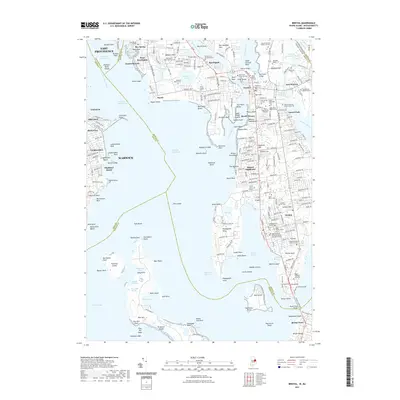
2021 Map of Bristol
USGS Topo · Published 2021About this map
Narragansett Bay and the Providence River define this coastal landscape, where the interconnected shorelines of Warwick, Barrington, and Bristol meet. The map reveals a densely settled maritime corridor characterized by numerous burial grounds and family plots that mark the long history of these Rhode Island communities. Significant landmarks like the Mount Hope Bridge connect the mainland to Bristol Ferry, while inland, water bodies such as Brickyard Pond and Echo Lake point to the area's diverse hydrologic profile.
Find a feature on this map
258 named features on this map. Tap any name to fly to it.
Don’t see what you’re looking for? This feature index may not catch every label — zoom into the map to look around manually.
Map Details
Editions of this 2021 Bristol Map
This is the sole edition of this map. No revisions or reprints were ever made.
Other maps of this area

1885 · Taunton
USGS Topo · 1:62,500

1887 · Providence
USGS Topo · 1:62,500

1888 · Fall River
USGS Topo · 1:62,500

1888 · Taunton
USGS Topo · 1:62,500

1889 · Providence
USGS Topo · 1:62,500

1890 · Narragansett Bay
USGS Topo · 1:62,500

1892 · Narragansett Bay
USGS Topo · 1:62,500

1893 · Taunton
USGS Topo · 1:62,500

1893 · Fall River
USGS Topo · 1:62,500

1894 · Providence
USGS Topo · 1:62,500