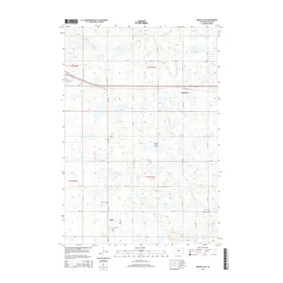
2015 Map of Bristol East
USGS Topo · Published 2015About this map
The Coteau des Prairies plateau defines the eastern South Dakota landscape shown in this 2015 survey. This distinctive upland region is marked by numerous prairie potholes and glacial depressions, most notably Holmquist Slough and the northern reaches of Bitter Lake. The settlement pattern reflects the traditional grid of the Great Plains, centered on the small communities of Holmquist and Butler. These towns grew along the transportation corridors that follow the township lines, including CR-18 and E Main St. For local historians and genealogists, the map identifies specific rural landmarks like Prairie Mound Cem and Ebenezer Cem, situated among the section lines and rolling terrain of the Coteau.
Find a feature on this map
21 named features on this map. Tap any name to fly to it.
Don’t see what you’re looking for? This feature index may not catch every label — zoom into the map to look around manually.
Map Details
Editions of this 2015 Bristol East Map
This is the sole edition of this map. No revisions or reprints were ever made.
Other maps of this area

1953 · Milbank
USGS Topo · 1:250,000

1958 · Milbank
USGS Topo · 1:250,000

1958 · Pierpont
USGS Topo · 1:24,000

1973 · Lily
USGS Topo · 1:24,000

1973 · Lynn Lake
USGS Topo · 1:24,000

1973 · Webster
USGS Topo · 1:24,000

1973 · Bristol West
USGS Topo · 1:24,000

1973 · Swan Lake
USGS Topo · 1:24,000

1973 · Lone Tree Lake
USGS Topo · 1:24,000

1973 · Bristol East
USGS Topo · 1:24,000