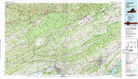
1981 Map of Bristol
USGS Topo · Published 1981About this map
The Clinch River and Holston River systems carve through the heart of the Ridge and Valley province in this 1981 survey. Centered on the Tri-Cities region, the map documents the industrial and academic foundations of the area, from the sprawling Holston Army Ammunition Plant near Kingsport to the historic grounds of King College in Bristol. The landscape is defined by the rigid parallel lines of Clinch Mountain and Powell Mountain, which dictated the path of the Clinchfield Railroad and Norfolk and Western Railway as they moved coal and goods through these narrow gaps.
Find a feature on this map
102 named features on this map. Tap any name to fly to it.
Don’t see what you’re looking for? This feature index may not catch every label — zoom into the map to look around manually.
Map Details
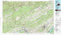
Editions of this 1981 Bristol Map
2 editions found
Other maps of this area

1883 · Morristown
USGS Topo · 1:125,000

1886 · Grundy
USGS Topo · 1:125,000

1887 · Jonesville
USGS Topo · 1:125,000

1890 · Whitesburg
USGS Topo · 1:125,000

1890 · Grundy
USGS Topo · 1:125,000

1891 · Tazewell
USGS Topo · 1:125,000

1891 · Hazard
USGS Topo · 1:125,000

1891 · Roan Mountain
USGS Topo · 1:125,000

1891 · Abingdon
USGS Topo · 1:125,000

1891 · Jonesville
USGS Topo · 1:125,000