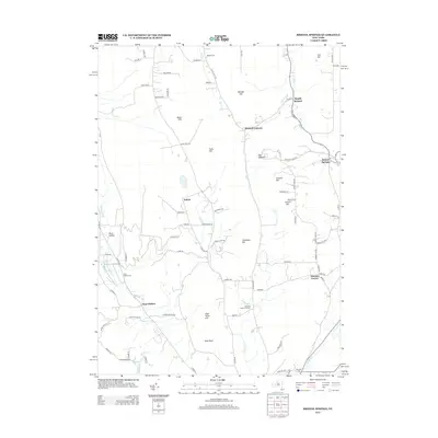
2013 Map of Bristol Springs
USGS Topo · Published 2013About this map
Honeoye Inlet meanders through the western valley of this Ontario County landscape, a region defined by its high ridges and small upland settlements. In the early 21st century, the area maintains a sparse, rural character where family-named landmarks like Stid Hill, Worden Hill, and Gannett Hill dominate the topography. Local history and genealogy are centered around crossroads like Bristol Springs and the former village site at Hunt Hollow VLG. The map captures a transition between the wilder heights and the agricultural valley floors, marked by features such as the Mountain Creek Herb Farm and the sprawling Camp Cutler BSA scout camp. Numerous small burying grounds, including Pamely Cem and Hunt Hollow Cem, are preserved near the winding courses of Grimes Cr and Mud Cr, documenting generations of settlement in this quiet corner of the Finger Lakes region.
Find a feature on this map
83 named features on this map. Tap any name to fly to it.
Don’t see what you’re looking for? This feature index may not catch every label — zoom into the map to look around manually.
Map Details
Editions of this 2013 Bristol Springs Map
This is the sole edition of this map. No revisions or reprints were ever made.
Other maps of this area

1900 · Naples
USGS Topo · 1:62,500

1900 · Canandaigua
USGS Topo · 1:62,500

1901 · Honeoye
USGS Topo · 1:62,500

1902 · Wayland
USGS Topo · 1:62,500

1903 · Naples
USGS Topo · 1:62,500

1903 · Canandaigua
USGS Topo · 1:62,500

1904 · Wayland
USGS Topo · 1:62,500

1904 · Honeoye
USGS Topo · 1:62,500

1913 · Naples
USGS Topo · 1:62,500

1942 · Springwater
USGS Topo · 1:31,680