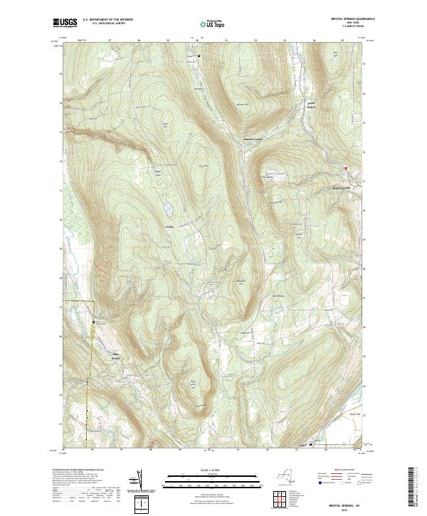
2023 Map of Bristol Springs
USGS Topo · Published 2023About this map
The deep ravines and high ridges of Ontario and Livingston counties define this terrain, where the Bristol Valley meets the steep western slopes of Stid Hill. The landscape is marked by a series of prominent peaks including Gannett Hill and High Point Hill, creating a dramatic verticality that has long influenced local settlement patterns. Small hamlets like South Bristol and Bristol Springs are situated in the lower elevations, while family-named landmarks such as Worden Hill and Cleveland Hill denote the historical significance of upland farming and land ownership.
Find a feature on this map
82 named features on this map. Tap any name to fly to it.
Don’t see what you’re looking for? This feature index may not catch every label — zoom into the map to look around manually.
Map Details
Editions of this 2023 Bristol Springs Map
This is the sole edition of this map. No revisions or reprints were ever made.
Other maps of this area

1900 · Naples
USGS Topo · 1:62,500

1900 · Canandaigua
USGS Topo · 1:62,500

1901 · Honeoye
USGS Topo · 1:62,500

1902 · Wayland
USGS Topo · 1:62,500

1903 · Naples
USGS Topo · 1:62,500

1903 · Canandaigua
USGS Topo · 1:62,500

1904 · Wayland
USGS Topo · 1:62,500

1904 · Honeoye
USGS Topo · 1:62,500

1913 · Naples
USGS Topo · 1:62,500

1942 · Springwater
USGS Topo · 1:31,680