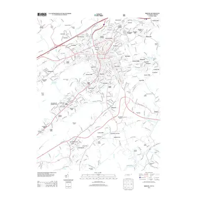
2013 Map of Bristol
USGS Topo · Published 2013About this map
Union Depot serves as a central anchor for this 2013 portrait of the cross-border hub, where the residential expansion of Tennessee and Virginia meets the natural topography of the Appalachian valley. The landscape is defined by a dense network of suburban developments like West Ridge, Marlyn Hills, and Deerfield Acres that have filled the spaces between historic knobs and ridges. Waterways such as Beaver Creek and Steele Creek wind through the urban fabric, while the South Fork Holston River defines the southeastern corner. Distinctive landmarks of mid-century growth remain visible, from the Twin City Drive-In to the Steele Creek Golf Course. This survey captures the region just as modern infrastructure and suburban neighborhoods fully integrated with older settlements like Vance and Avoca.
Find a feature on this map
93 named features on this map. Tap any name to fly to it.
Don’t see what you’re looking for? This feature index may not catch every label — zoom into the map to look around manually.
Map Details
Editions of this 2013 Bristol Map
This is the sole edition of this map. No revisions or reprints were ever made.
Other maps of this area

1891 · Roan Mountain
USGS Topo · 1:125,000

1894 · Roan Mountain
USGS Topo · 1:125,000

1897 · Bristol
USGS Topo · 1:125,000

1902 · Bristol
USGS Topo · 1:125,000

1904 · Roan Mountain
USGS Topo · 1:125,000

1934 · Wallace
USGS Topo · 1:24,000

1934 · Holston Valley
USGS Topo · 1:24,000

1934 · Wyndale
USGS Topo · 1:24,000

1934 · Bristol
USGS Topo · 1:24,000

1935 · Watauga Valley
USGS Topo · 1:48,000