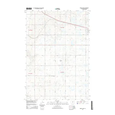
2015 Map of Bristol West
USGS Topo · Published 2015About this map
The Coteau des Prairies plateau defines this landscape in Day County, where the high prairie is pockmarked with numerous small glacial depressions and wetlands. This 2015 survey shows a rural environment structured by a strict section-line road grid, including 145th St and 420th Ave. For those tracing local history, the Bethany Evangelical Cem serves as a significant landmark of the area's spiritual and community roots. To the southwest, the seasonal drainage of Mud Cr meanders through the terrain, while the northeast corner is intersected by a diagonal rail line. The map captures a moment of modern rural life where traditional land divisions of the Public Land Survey System, such as t122n r58w, remain the primary framework for contemporary navigation and land management.
Find a feature on this map
26 named features on this map. Tap any name to fly to it.
Don’t see what you’re looking for? This feature index may not catch every label — zoom into the map to look around manually.
Map Details
Editions of this 2015 Bristol West Map
This is the sole edition of this map. No revisions or reprints were ever made.
Other maps of this area

1953 · Milbank
USGS Topo · 1:250,000

1958 · Milbank
USGS Topo · 1:250,000

1958 · Andover
USGS Topo · 1:24,000

1958 · Andover SW
USGS Topo · 1:24,000

1958 · Pierpont
USGS Topo · 1:24,000
1958 · Crandall
USGS Topo · 1:24,000

1973 · Lily
USGS Topo · 1:24,000

1973 · Lynn Lake
USGS Topo · 1:24,000

1973 · Bristol West
USGS Topo · 1:24,000

1973 · Lone Tree Lake
USGS Topo · 1:24,000