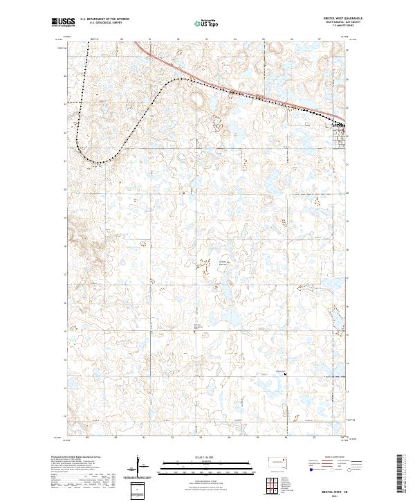
2021 Map of Bristol West
USGS Topo · Published 2021About this map
The Coteau des Prairies, a vast glacial upland, dominates the topography of this South Dakota landscape. The terrain is defined by a dense concentration of wetlands and prairie potholes, typical of this physiographic region. On the northeastern edge of the sheet, the community of Bristol sits at the intersection of local roads, serving as a hub for the surrounding agricultural sections. The map is a vital resource for genealogists and local historians, as it identifies small, rural burial sites such as Bethany Evangelical Cem and Sjurson Cem which are often tucked away in the open country far from town centers. These features, along with the meandering course of Mud Cr, illustrate the rural character and the historic settlement patterns of Day County in the early twenty-first century.
Find a feature on this map
25 named features on this map. Tap any name to fly to it.
Don’t see what you’re looking for? This feature index may not catch every label — zoom into the map to look around manually.
Map Details
Editions of this 2021 Bristol West Map
This is the sole edition of this map. No revisions or reprints were ever made.
Other maps of this area

1953 · Milbank
USGS Topo · 1:250,000

1958 · Milbank
USGS Topo · 1:250,000

1958 · Andover
USGS Topo · 1:24,000

1958 · Andover SW
USGS Topo · 1:24,000

1958 · Pierpont
USGS Topo · 1:24,000
1958 · Crandall
USGS Topo · 1:24,000

1973 · Lily
USGS Topo · 1:24,000

1973 · Lynn Lake
USGS Topo · 1:24,000

1973 · Bristol West
USGS Topo · 1:24,000

1973 · Lone Tree Lake
USGS Topo · 1:24,000