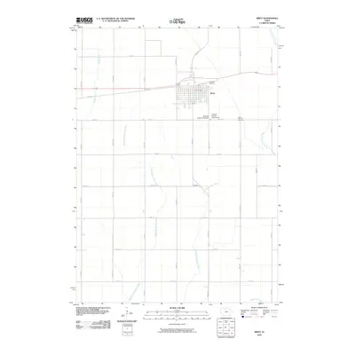
2010 Map of Britt
USGS Topo · Published 2010About this map
Britt serves as the primary municipal center in this section of north-central Iowa, situated among the headwaters of several major waterways. The town layout is clearly defined, featuring the Britt Post Office and community landmarks such as the Hancock County Fairgrounds and Hancock County Speedway. Local history is anchored by the Evergreen Cemetery on the northeastern edge of town and Saint Patricks Cemetery to the southeast near Kent Ave.
Find a feature on this map
29 named features on this map. Tap any name to fly to it.
Don’t see what you’re looking for? This feature index may not catch every label — zoom into the map to look around manually.
Map Details
Editions of this 2010 Britt Map
This is the sole edition of this map. No revisions or reprints were ever made.
Other maps of this area

1954 · Mason City
USGS Topo · 1:250,000

1954 · Waterloo
USGS Topo · 1:250,000

1955 · Waterloo
USGS Topo · 1:250,000

1957 · Mason City
USGS Topo · 1:250,000

1958 · Mason City
USGS Topo · 1:250,000

1972 · Corwith
USGS Topo · 1:24,000

1972 · Kanawha
USGS Topo · 1:24,000

1972 · Hayfield
USGS Topo · 1:24,000

1972 · Olaf
USGS Topo · 1:24,000

1972 · Crystal Lake
USGS Topo · 1:24,000