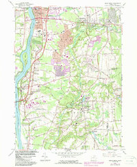
2024 Map of Broad Brook
USGS Topo · Published 2024About this map
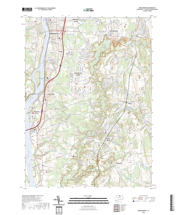
Enfield and its surrounding mill towns are defined by the hydraulic power of the Scantic River and the industrial corridor of the Connecticut River. This 2024 survey documents the dense residential development in Sherwood Manor and Southwood Acres alongside long-standing agricultural landmarks like Roberts Farm Airport. The map highlights a significant concentration of local heritage sites, from the Enfield Street Cem and New Saint Patricks Cem to the milling history evidenced by Broad Brook Millpond and Sadds Mill Pond. Water features such as Freshwater Brook and Stoughton Brook cut through the landscape, while the Enfield Falls and Kings Island mark the river’s western edge. Educational and civic anchors including Asnuntuck Community College and the Superior Court are clearly delineated among the established street grids.
Find a feature on this map
266 named features on this map. Tap any name to fly to it.
Don’t see what you’re looking for? This feature index may not catch every label — zoom into the map to look around manually.
Map Details
Editions of this 2024 Broad Brook Map
This is the sole edition of this map. No revisions or reprints were ever made.
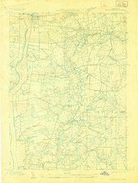
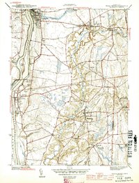
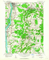
Historical Maps of Mill Pond Village Through Time
5 maps found