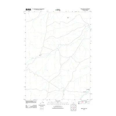
2012 Map of Broad Mesa
USGS Topo · Published 2012About this map
One Hundred and Two Ranch sits within a landscape defined by the drainage basins of central Wyoming, where the high ground of Broad Mesa overlooks a network of intermittent waterways. This 2012 survey by the U.S. Geological Survey illustrates the remote ranching infrastructure of Natrona County, where land use is dictated by the flow of Wallace Cr and the Middle Fork Casper Cr. Transportation through this territory relies on established routes such as the Powder River Rd and Co Rd 211, which provide essential access for agricultural operations. The map also records localized land features like McClanahan Draw, reflecting the specific topographic nomenclature used by local residents and land managers in the early 21st century.
Find a feature on this map
7 named features on this map. Tap any name to fly to it.
Don’t see what you’re looking for? This feature index may not catch every label — zoom into the map to look around manually.
Map Details
Editions of this 2012 Broad Mesa Map
This is the sole edition of this map. No revisions or reprints were ever made.
Other maps of this area

1952 · Waltman
USGS Topo · 1:24,000

1952 · Hiland
USGS Topo · 1:24,000

1955 · Arminto
USGS Topo · 1:250,000

1955 · Casper
USGS Topo · 1:250,000

1958 · Casper
USGS Topo · 1:250,000

1958 · Arminto
USGS Topo · 1:250,000

1959 · Gaylord Reservoir
USGS Topo · 1:24,000

1959 · Eightmile Draw
USGS Topo · 1:24,000

1959 · Broad Mesa
USGS Topo · 1:24,000
1959 · Mc Rae Gap
USGS Topo · 1:24,000