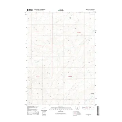
2015 Map of Broad Mesa
USGS Topo · Published 2015About this map
Broad Mesa dominates the northern horizon of this Natrona County landscape, a prominent high plateau that defines the local watershed. Water drainage from these heights carves distinct paths through the terrain, most notably along Wallace Cr as it winds through the central and western sections of the map. To the southeast, the geography shifts toward McClanahan Draw and the headwaters of the Middle Fork Casper Cr. The region is defined by large-scale land divisions, including t35n r87w and t35n r86w, suggesting a pattern of extensive ranching or resource management common in the Wyoming interior during this era. Transportation is largely limited to the arterial Powder River Rd, which serves as the primary corridor through this open range country.
Find a feature on this map
9 named features on this map. Tap any name to fly to it.
Don’t see what you’re looking for? This feature index may not catch every label — zoom into the map to look around manually.
Map Details
Editions of this 2015 Broad Mesa Map
This is the sole edition of this map. No revisions or reprints were ever made.
Other maps of this area

1952 · Waltman
USGS Topo · 1:24,000

1952 · Hiland
USGS Topo · 1:24,000

1955 · Arminto
USGS Topo · 1:250,000

1955 · Casper
USGS Topo · 1:250,000

1958 · Casper
USGS Topo · 1:250,000

1958 · Arminto
USGS Topo · 1:250,000

1959 · Gaylord Reservoir
USGS Topo · 1:24,000

1959 · Eightmile Draw
USGS Topo · 1:24,000

1959 · Broad Mesa
USGS Topo · 1:24,000
1959 · Mc Rae Gap
USGS Topo · 1:24,000