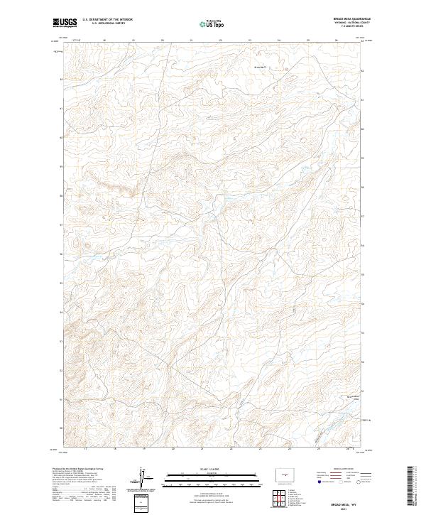
2021 Map of Broad Mesa
USGS Topo · Published 2021About this map
Broad Mesa defines the high ground of this central Wyoming landscape, where the drainage patterns of the high plains shape the local geography. The area is characterized by the seasonal flow of Wallace Cr and the Middle Fork Casper Cr, which carve through the terrain toward the southeast. These watercourses are flanked by topographical features like McClanahan Draw, illustrating the erosional processes that have defined this portion of Natrona County. Transportation in this sparsely populated region is limited to essential corridors like Powder River Rd and Co Rd 211, reflecting a landscape dedicated to ranching and open-range land use. The map provides a detailed view of the Public Land Survey System divisions, including t35n r87w and t35n r86w, which trace the legal boundaries of a region where human footprint remains light against the sprawling mesa.
Find a feature on this map
10 named features on this map. Tap any name to fly to it.
Don’t see what you’re looking for? This feature index may not catch every label — zoom into the map to look around manually.
Map Details
Editions of this 2021 Broad Mesa Map
This is the sole edition of this map. No revisions or reprints were ever made.
Other maps of this area

1952 · Waltman
USGS Topo · 1:24,000

1952 · Hiland
USGS Topo · 1:24,000

1955 · Arminto
USGS Topo · 1:250,000

1955 · Casper
USGS Topo · 1:250,000

1958 · Casper
USGS Topo · 1:250,000

1958 · Arminto
USGS Topo · 1:250,000

1959 · Gaylord Reservoir
USGS Topo · 1:24,000

1959 · Eightmile Draw
USGS Topo · 1:24,000

1959 · Broad Mesa
USGS Topo · 1:24,000
1959 · Mc Rae Gap
USGS Topo · 1:24,000