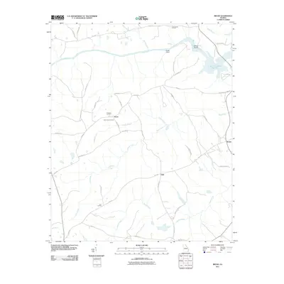
2011 Map of Broad
USGS Topo · Published 2011About this map
The Broad River defines the northern landscape of this region, meeting the upper reaches of the J. Strom Thurmond Reservoir at Anthony Shoals. This 2011 survey captures a quiet, rural corner of Georgia where small settlements and crossroads communities like Broad, Delhi, and Beulah are connected by a network of named country roads. The distribution of family and community landmarks, such as Popes Chapel Cemetery and Tabor Cemetery, provides essential geographic markers for genealogical research in Wilkes County. The terrain is deeply etched by a drainage system including Pistol Creek and Newford Creek, which flow through a landscape dominated by timberland and small clearings. Notable landmarks like Green Island and the intersection of historic routes such as Mallorysville Lisbon Rd illustrate the enduring physical layout of these traditional Piedmont communities.
Find a feature on this map
45 named features on this map. Tap any name to fly to it.
Don’t see what you’re looking for? This feature index may not catch every label — zoom into the map to look around manually.
Map Details
Editions of this 2011 Broad Map
This is the sole edition of this map. No revisions or reprints were ever made.
Other maps of this area

1893 · Elberton
USGS Topo · 1:125,000

1906 · Crawfordville
USGS Topo · 1:125,000

1953 · Athens
USGS Topo · 1:250,000

1954 · Metasville
USGS Topo · 1:24,000

1954 · Greenville
USGS Topo · 1:250,000

1955 · Tignall
USGS Topo · 1:24,000

1955 · Broad
USGS Topo · 1:24,000

1955 · Chennault
USGS Topo · 1:24,000

1958 · Greenville
USGS Topo · 1:250,000

1958 · Athens
USGS Topo · 1:250,000