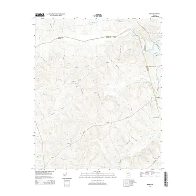
2014 Map of Broad
USGS Topo · Published 2014About this map
Broad River serves as the prominent natural boundary between Elbert, Wilkes, and Lincoln counties, flowing toward the eastern reaches of the J. Strom Thurmond Reservoir. The landscape is characterized by a network of small creeks like Pistol Cr and Newford Cr that drain the undulating terrain of the Georgia Piedmont. This modern survey shows the area's rural continuity, centered around small communities such as Broad, Delhi, and Beulah. Local genealogy is well-documented through several historic burial sites, including Friendship Cem, Popes Chapel Cem, and Tabor Cem. The presence of Anthony Shoals on the river and a dense web of named local roads, such as Delhi Rd and Flatrock Rd, illustrates the enduring rural infrastructure of Wilkes County into the early 21st century.
Find a feature on this map
61 named features on this map. Tap any name to fly to it.
Don’t see what you’re looking for? This feature index may not catch every label — zoom into the map to look around manually.
Map Details
Editions of this 2014 Broad Map
This is the sole edition of this map. No revisions or reprints were ever made.
Other maps of this area

1893 · Elberton
USGS Topo · 1:125,000

1906 · Crawfordville
USGS Topo · 1:125,000

1953 · Athens
USGS Topo · 1:250,000

1954 · Metasville
USGS Topo · 1:24,000

1954 · Greenville
USGS Topo · 1:250,000

1955 · Tignall
USGS Topo · 1:24,000

1955 · Broad
USGS Topo · 1:24,000

1955 · Chennault
USGS Topo · 1:24,000

1958 · Greenville
USGS Topo · 1:250,000

1958 · Athens
USGS Topo · 1:250,000