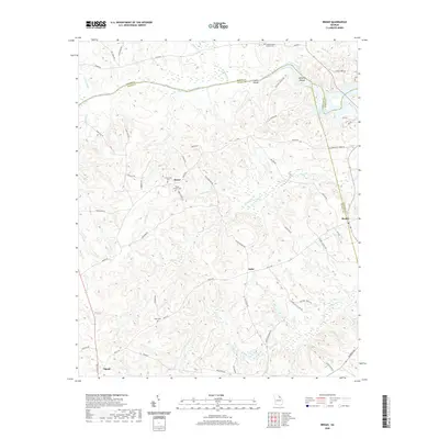
2020 Map of Broad
USGS Topo · Published 2020About this map
Anthony Shoals and the surrounding riverine landscape define this area where Elbert and Wilkes Counties meet. The Broad River serves as a natural boundary, winding past Green Island and eventually feeding into the J. Strom Thurmond Reservoir at the eastern edge of the quadrangle. This 2020 record illustrates a rural Georgia landscape where small crossroads like Delhi and Beulah are connected by local routes such as Mallorysville Lisbon Road and Delhi Road.
Find a feature on this map
66 named features on this map. Tap any name to fly to it.
Don’t see what you’re looking for? This feature index may not catch every label — zoom into the map to look around manually.
Map Details
Editions of this 2020 Broad Map
This is the sole edition of this map. No revisions or reprints were ever made.
Other maps of this area

1893 · Elberton
USGS Topo · 1:125,000

1906 · Crawfordville
USGS Topo · 1:125,000

1953 · Athens
USGS Topo · 1:250,000

1954 · Metasville
USGS Topo · 1:24,000

1954 · Greenville
USGS Topo · 1:250,000

1955 · Tignall
USGS Topo · 1:24,000

1955 · Broad
USGS Topo · 1:24,000

1955 · Chennault
USGS Topo · 1:24,000

1958 · Greenville
USGS Topo · 1:250,000

1958 · Athens
USGS Topo · 1:250,000