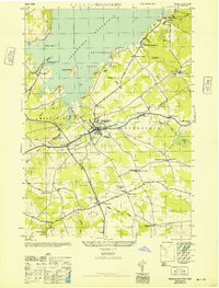
1946 Map of Broadalbin
USGS Topo · Published 1946About this map
Sacandaga Reservoir dominates the northern landscape of this mid-1940s survey, marking a significant transformation of the upper Hudson valley. The shoreline is punctuated by local landmarks like Vandenburgh Point and Beacon Island, while the southern reaches of the Adirondack State Park encompass the hills above North Broadalbin. This era shows a well-connected rural economy, where the Fonda Johnstown and Gloversville railroad and state highways converge at Broadalbin and Vail Mills.
Find a feature on this map
47 named features on this map. Tap any name to fly to it.
Don’t see what you’re looking for? This feature index may not catch every label — zoom into the map to look around manually.
Map Details
Editions of this 1946 Broadalbin Map
This is the sole edition of this map. No revisions or reprints were ever made.
Other maps of this area

1895 · Amsterdam
USGS Topo · 1:62,500

1896 · Fonda
USGS Topo · 1:62,500

1898 · Fonda
USGS Topo · 1:62,500

1899 · Broadalbin
USGS Topo · 1:62,500

1902 · Broadalbin
USGS Topo · 1:62,500

1902 · Fonda
USGS Topo · 1:62,500

1903 · Gloversville
USGS Topo · 1:62,500

1931 · Amsterdam
USGS Topo · 1:62,500

1943 · Gloversville
USGS Topo · 1:62,500
1944 · Tribes Hill
USGS Topo · 1:24,000