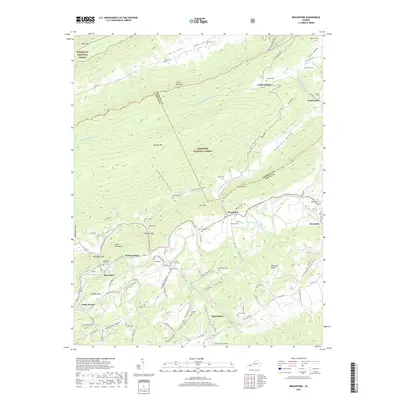
2019 Map of Broadford
USGS Topo · Published 2019About this map
Clinch Mountain and Flattop Mtn dominate the landscape of the southwestern Virginia highlands, where the border between Tazewell and Smyth counties follows the high ridgelines of the Jefferson National Forest. This 2019 survey documents a series of rural valley settlements including Broadford, Tannersville, and McCready that have long been defined by the parallel folds of the Appalachian mountains. The North Fork Holston River winds through the southern valleys, flanked by historical community nodes like North Holston and Riverside. This map is particularly valuable for genealogists, as it meticulously identifies numerous family burial sites tucked into the hollows, such as the Gollehon Cem, Keister Cem, and McAllister Cem. The transition from the high elevations of Ward Cove down to the agricultural lands of Rich Valley illustrates the complex geography that shaped local commerce at Osborns Store and early industrial sites along the river.
Find a feature on this map
108 named features on this map. Tap any name to fly to it.
Don’t see what you’re looking for? This feature index may not catch every label — zoom into the map to look around manually.
Map Details
Editions of this 2019 Broadford Map
This is the sole edition of this map. No revisions or reprints were ever made.
Other maps of this area

1891 · Tazewell
USGS Topo · 1:125,000

1891 · Abingdon
USGS Topo · 1:125,000

1894 · Abingdon
USGS Topo · 1:125,000

1895 · Tazewell
USGS Topo · 1:125,000

1897 · Tazewell
USGS Topo · 1:125,000

1909 · Abingdon
USGS Topo · 1:96,000

1911 · Abingdon
USGS Topo · 1:125,000

1912 · Pounding Mill
USGS Topo · 1:62,500

1915 · Richlands
USGS Topo · 1:48,000

1916 · Pounding Mill
USGS Topo · 1:62,500