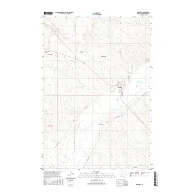
2017 Map of Broadus
USGS Topo · Published 2017About this map
Broadus sits as the central hub of this 2017 Montana landscape, positioned where the Lone Tree Cr meets the winding Powder River. The town's grid is clearly defined by local streets such as Trautman Ave and Wilbur Ave, while the Broadus Airport provides a key transportation link to this ranching country. The surrounding terrain is characterized by a network of drainage systems, including Government Cr, Coyote Cr, and N Fork Sand Cr, which carve through the high plains topography. Significant local landmarks like Preston Buttes, Fivemile Hill, and Sand Creek Hill offer prominent navigational points for those familiar with the area. Genealogists and local historians can locate the Valley View Cem northeast of the town center, while evidence of agricultural water management is seen in the Randall Ditch to the south.
Find a feature on this map
46 named features on this map. Tap any name to fly to it.
Don’t see what you’re looking for? This feature index may not catch every label — zoom into the map to look around manually.
Map Details
Editions of this 2017 Broadus Map
This is the sole edition of this map. No revisions or reprints were ever made.
Other maps of this area

1954 · Ekalaka
USGS Topo · 1:250,000

1956 · Ekalaka
USGS Topo · 1:250,000

1958 · Ekalaka
USGS Topo · 1:250,000

1965 · Ekalaka
USGS Topo · 1:250,000

1973 · Olive
USGS Topo · 1:24,000

1973 · Lonesome Peak
USGS Topo · 1:24,000

1973 · Monday Creek
USGS Topo · 1:24,000

1973 · Moonlight Creek
USGS Topo · 1:24,000

1973 · Hawkey Creek
USGS Topo · 1:24,000
1973 · Fighting Butte
USGS Topo · 1:24,000