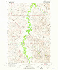
1973 Map of Fighting Butte
USGS Topo · Published 1976About this map
The Little Powder River meanders through this portion of Powder River County, Montana, providing a stark contrast to the surrounding high country. The river valley is the central artery for water management in this arid landscape, evidenced by the presence of the Waite Ditch and the East Fork Little Powder River confluence. These waterways supported ranching operations that relied on scattered water sources, including several identified as Flowing Well.
Find a feature on this map
16 named features on this map. Tap any name to fly to it.
Don’t see what you’re looking for? This feature index may not catch every label — zoom into the map to look around manually.
Map Details
Editions of this 1973 Fighting Butte Map
This is the sole edition of this map. No revisions or reprints were ever made.
Other maps of this area

1954 · Ekalaka
USGS Topo · 1:250,000

1956 · Ekalaka
USGS Topo · 1:250,000

1958 · Ekalaka
USGS Topo · 1:250,000

1965 · Ekalaka
USGS Topo · 1:250,000

1970 · Pine Creek
USGS Topo · 1:24,000

1970 · Sanburn Reservoir
USGS Topo · 1:24,000

1970 · Bear Skull Mountain
USGS Topo · 1:24,000

1973 · Monday Creek
USGS Topo · 1:24,000
1973 · Eldon Mountain
USGS Topo · 1:24,000
1973 · Broadus
USGS Topo · 1:24,000