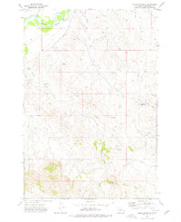
1973 Map of Eldon Mountain
USGS Topo · Published 1976About this map
The Powder River winds through the northern portion of this landscape, its path supported by the Randall Ditch irrigation system. In this corner of Powder River County during the early 1970s, the terrain is defined by its drainages and distinctive high points, including the namesake Eldon Mountain and the prominent Castle Rock. Cattle ranching and land management are evident through the network of water resources such as Hondu Reservoir, Garr Reservoir, and Forsgreen Reservoir, alongside several scattered wells and flowing wells.
Find a feature on this map
22 named features on this map. Tap any name to fly to it.
Don’t see what you’re looking for? This feature index may not catch every label — zoom into the map to look around manually.
Map Details
Editions of this 1973 Eldon Mountain Map
This is the sole edition of this map. No revisions or reprints were ever made.
Other maps of this area

1954 · Ekalaka
USGS Topo · 1:250,000

1956 · Ekalaka
USGS Topo · 1:250,000

1958 · Ekalaka
USGS Topo · 1:250,000

1965 · Ekalaka
USGS Topo · 1:250,000

1970 · Pine Creek
USGS Topo · 1:24,000

1970 · Baldy Peak
USGS Topo · 1:24,000

1970 · Bear Skull Mountain
USGS Topo · 1:24,000

1973 · Lonesome Peak
USGS Topo · 1:24,000

1973 · Monday Creek
USGS Topo · 1:24,000
1973 · Fighting Butte
USGS Topo · 1:24,000