2024 Map of Broadus
USGS Topo · Published 2024About this map
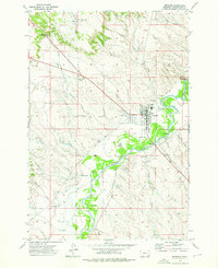
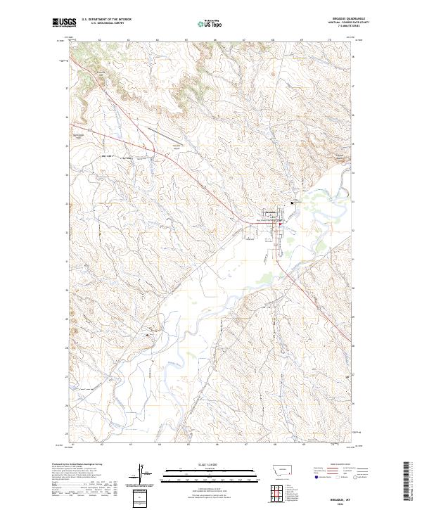
Broadus serves as the focal point of this Eastern Montana landscape, situated along the winding course of the Powder River. The town's grid is anchored by the Powder River County Courthouse and serves the surrounding ranching and agricultural community through infrastructure like the Broadus Airport. The terrain is characterized by a network of seasonal drainages and irrigation works, including the Randall Ditch and North Fork Sand Creek, which carve through the high plains toward the river valley. To the northeast, the distinct forms of Preston Buttes and Fivemile Hill rise above the drainage basins of Coyote Creek and Government Creek. Local history is preserved at the Valley View Cem, located just east of the main settlement. The map detail highlights the intersection of traditional land use and modern transport, with routes like Moorehead Rd and Big Powder River East Rd following the natural contours of the river terrace.
Find a feature on this map
40 named features on this map. Tap any name to fly to it.
Don’t see what you’re looking for? This feature index may not catch every label — zoom into the map to look around manually.
Map Details
Editions of this 2024 Broadus Map
This is the sole edition of this map. No revisions or reprints were ever made.
Historical Maps of Town and Country Trailer Park Through Time
3 maps found