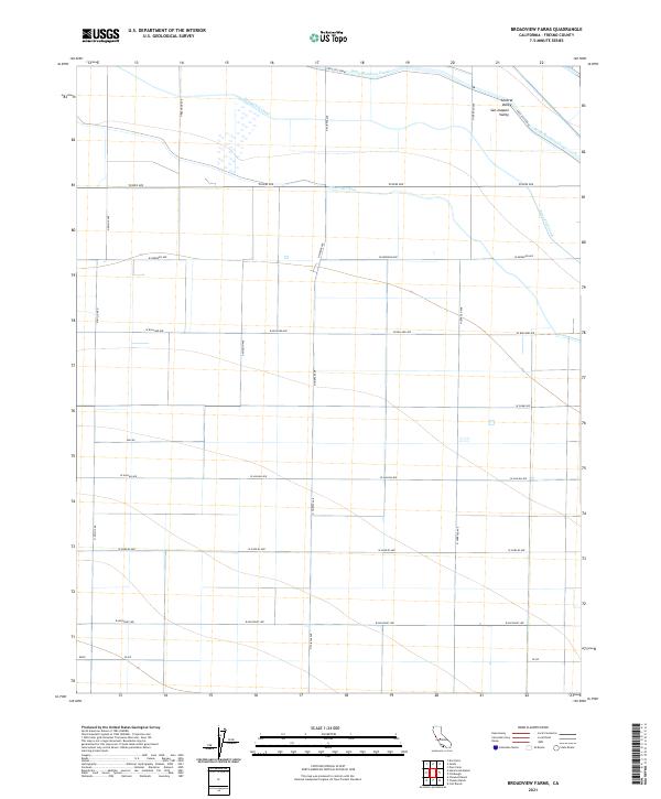
2021 Map of Broadview Farms
USGS Topo · Published 2021About this map
Agricultural infrastructure dominates this part of the Central Valley within the San Joaquin Valley, where an intricate network of waterways supports the regional economy. The massive Delta-Mendota Canal cuts through the northern landscape, supported by several artificial arteries including the First Lift Canal, Second Lift Canal, and Third Lift Canal. These engineering feats enable the cultivation of the surrounding ranchlands and farm plots.
Find a feature on this map
26 named features on this map. Tap any name to fly to it.
Don’t see what you’re looking for? This feature index may not catch every label — zoom into the map to look around manually.
Map Details
Editions of this 2021 Broadview Farms Map
This is the sole edition of this map. No revisions or reprints were ever made.
Other maps of this area

1913 · Panoche
USGS Topo · 1:125,000

1921 · Tierra Loma School
USGS Topo · 1:31,680

1922 · Oxalis
USGS Topo · 1:31,680

1922 · Dos Palos
USGS Topo · 1:31,680

1922 · Tufts Ranch
USGS Topo · 1:31,680

1922 · Pozo Farm
USGS Topo · 1:31,680

1922 · Chaney Ranch
USGS Topo · 1:31,680

1923 · Wisdom Well
USGS Topo · 1:31,680

1923 · Firebaugh
USGS Topo · 1:31,680

1923 · Tierra Loma School
USGS Topo · 1:31,680