
1923 Map of Wisdom Well
USGS Topo · Published 1923About this map
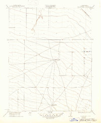
The western San Joaquin Valley landscape in Fresno County is captured here during the early 1920s, revealing an era of isolated ranching and cattle grazing prior to the intensive industrial irrigation that later transformed the region. The map shows a network of wagon roads and tracks converging on Sheep Ranch, a central node in this arid terrain. Further south, the namesake Wisdom Well serves as a vital water source, indicating the importance of groundwater for survival in this dry stretch of the valley. Notable for historical transport researchers, the Old Santa Fe Grade cuts across the northeastern corner, marking an early transportation corridor through the plains. The sparse distribution of named features underscores the remote character of this landscape when William D. Stephens served as Governor and the state's engineering focused on managing these interior lands.
Find a feature on this map
5 named features on this map. Tap any name to fly to it.
Don’t see what you’re looking for? This feature index may not catch every label — zoom into the map to look around manually.
Map Details
Editions of this 1923 Wisdom Well Map
2 editions found
Other maps of this area

1913 · Panoche
USGS Topo · 1:125,000

1921 · Tierra Loma School
USGS Topo · 1:31,680

1922 · Oxalis
USGS Topo · 1:31,680

1922 · Dos Palos
USGS Topo · 1:31,680

1922 · Tufts Ranch
USGS Topo · 1:31,680

1922 · Pozo Farm
USGS Topo · 1:31,680

1922 · Chaney Ranch
USGS Topo · 1:31,680

1923 · Firebaugh
USGS Topo · 1:31,680

1923 · Tierra Loma School
USGS Topo · 1:31,680

1923 · Little Panoche
USGS Topo · 1:31,680