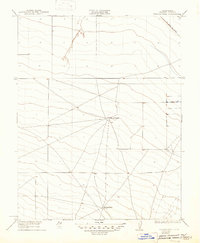
1923 Map of Wisdom Well
USGS Topo · Published 1947About this map
Wisdom Well anchors the southern reaches of this 1923 survey in western Fresno County, a landscape defined by expansive ranching operations and early transportation corridors. The terrain is marked by a complex network of trails and unimproved roads that converge at the Sheep Ranch, a significant local node in an otherwise sparse agricultural district. Surveyed by C.H. Birdseye and Geo. R. Davis in cooperation with the State of California, the sheet documents a period of transition in the San Joaquin Valley. In the northeast corner, the Old Santa Fe Grade traces a diagonal path across the landscape, preserving the alignment of historic freighting or rail transit. This high-resolution topographic study reveals the subtle water management and livestock patterns essential to the region's early twentieth-century economy.
Find a feature on this map
3 named features on this map. Tap any name to fly to it.
Don’t see what you’re looking for? This feature index may not catch every label — zoom into the map to look around manually.
Map Details
Editions of this 1923 Wisdom Well Map
2 editions found
Other maps of this area

1913 · Panoche
USGS Topo · 1:125,000

1921 · Tierra Loma School
USGS Topo · 1:31,680

1922 · Oxalis
USGS Topo · 1:31,680

1922 · Dos Palos
USGS Topo · 1:31,680

1922 · Tufts Ranch
USGS Topo · 1:31,680

1922 · Pozo Farm
USGS Topo · 1:31,680

1922 · Chaney Ranch
USGS Topo · 1:31,680

1923 · Wisdom Well
USGS Topo · 1:31,680

1923 · Firebaugh
USGS Topo · 1:31,680

1923 · Tierra Loma School
USGS Topo · 1:31,680