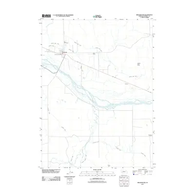
2011 Map of Broadwater
USGS Topo · Published 2011About this map
The village of Broadwater serves as the focal point of this western Nebraska landscape, where the braided channels of the North Platte River dictate the region's agricultural and civil layout. This 2011 survey highlights an intricate irrigation infrastructure essential to the High Plains, featuring the Browns Creek Canal, Beerline Canal, and the extensive Belmont Canal winding through the terrain. These man-made waterways support the local economy alongside transportation markers like the Ag Air Airport and the village's rail-aligned streets.
Find a feature on this map
18 named features on this map. Tap any name to fly to it.
Don’t see what you’re looking for? This feature index may not catch every label — zoom into the map to look around manually.
Map Details
Editions of this 2011 Broadwater Map
This is the sole edition of this map. No revisions or reprints were ever made.
Other maps of this area

1896 · Browns Creek
USGS Topo · 1:125,000

1899 · Browns Creek
USGS Topo · 1:125,000

1899 · Sidney
USGS Topo · 1:125,000

1954 · Scottsbluff
USGS Topo · 1:250,000

1958 · Scottsbluff
USGS Topo · 1:250,000

1965 · Broadwater
USGS Topo · 1:24,000

1965 · Broadwater NW
USGS Topo · 1:24,000

1965 · Broadwater SW
USGS Topo · 1:24,000

1965 · Broadwater NE
USGS Topo · 1:24,000

1971 · Tar Valley SW
USGS Topo · 1:24,000