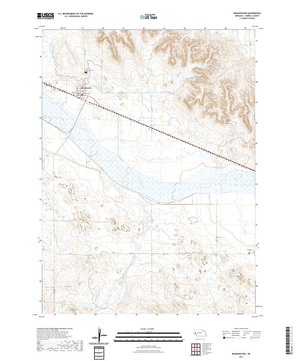
2021 Map of Broadwater
USGS Topo · Published 2021About this map
The North Platte River creates a wide, braided path across this portion of Morrill County, defining a landscape shaped by an extensive network of human-made waterways. To the north of the river, the village of Broadwater sits at the junction of Alliance Rd and Smith St, serving as a hub for the surrounding agricultural valley. The intricate irrigation system is evident through the winding paths of the Beerline Canal, Belmont Canal, and the Radcliffe Number 3 Canal, which draw water from the river to support the local plains.
Find a feature on this map
29 named features on this map. Tap any name to fly to it.
Don’t see what you’re looking for? This feature index may not catch every label — zoom into the map to look around manually.
Map Details
Editions of this 2021 Broadwater Map
This is the sole edition of this map. No revisions or reprints were ever made.
Other maps of this area

1896 · Browns Creek
USGS Topo · 1:125,000

1899 · Browns Creek
USGS Topo · 1:125,000

1899 · Sidney
USGS Topo · 1:125,000

1954 · Scottsbluff
USGS Topo · 1:250,000

1958 · Scottsbluff
USGS Topo · 1:250,000

1965 · Broadwater
USGS Topo · 1:24,000

1965 · Broadwater NW
USGS Topo · 1:24,000

1965 · Broadwater SW
USGS Topo · 1:24,000

1965 · Broadwater NE
USGS Topo · 1:24,000

1971 · Tar Valley SW
USGS Topo · 1:24,000