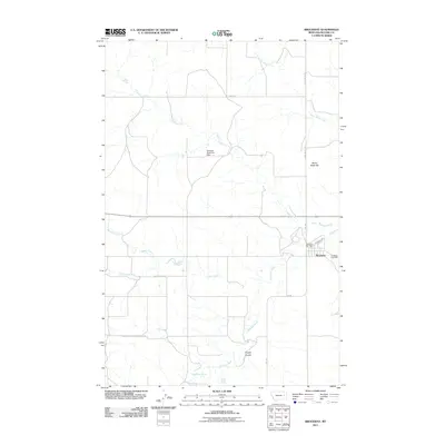
2011 Map of Brockway
USGS Topo · Published 2011About this map
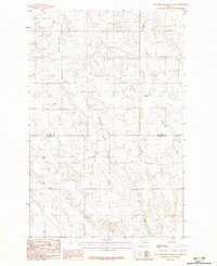
The settlement of Brockway sits at a geographic crossroads in McCone County, where the Redwater River meets tributaries like Ash Creek. This 2011 survey reveals a landscape defined by its water management and road network, centered on the Brockway Post Office and the town's grid. To the north, the Essinger Reservoir Dam regulates local waters, while the prominent Stony Butte Hill overlooks the surrounding plains. The map records the persistence of rural infrastructure, with roads like Railroad Ave and Fas 253 connecting the town to the outlying drainages of Stony Butte Creek, Cotter Creek, and Beauty Creek. Genealogists will find the exact location of the Brockway Cemetery east of the main townsite. The terrain is marked by distinctive features such as Fryxell Coulee and Dirty Creek, illustrating the complex drainage patterns of this Montana prairie region.
Find a feature on this map
19 named features on this map. Tap any name to fly to it.
Don’t see what you’re looking for? This feature index may not catch every label — zoom into the map to look around manually.
Map Details
Editions of this 2011 Brockway Map
This is the sole edition of this map. No revisions or reprints were ever made.
Other maps of this area

1954 · Glendive
USGS Topo · 1:250,000

1957 · Glendive
USGS Topo · 1:250,000
1958 · Glendive
USGS Topo · 1:250,000
1965 · Watkins
USGS Topo · 1:24,000
1965 · Berry School
USGS Topo · 1:24,000
1982 · Circle
USGS Topo · 1:100,000
1983 · Youngquist Mine
USGS Topo · 1:24,000
1983 · Brockway NE
USGS Topo · 1:24,000
1983 · Brockway
USGS Topo · 1:24,000
1983 · Big Sheep Mountain NW
USGS Topo · 1:24,000