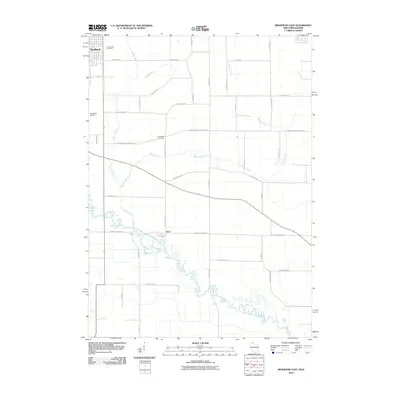
2010 Map of Brodhead East
USGS Topo · Published 2010About this map
The city of Brodhead anchors the northwestern corner of this 2010 landscape, situated at the edge of Green County where the terrain meets the winding course of the Sugar River. This river system, including its many oxbows and the drainage of Taylor Creek and Willow Creek, dominates the lower half of the quadrangle. The settlement of Avon sits further south, marking a secondary focal point in a region characterized by a dense grid of rural roads named for local families and landmarks, such as Bohnhoff Rd and S Nelson Rd. Genealogists may find value in the placement of Greenwood Cemetery on the outskirts of the city and Northrup Cemetery further east. The presence of Brodhead Airport north of the river highlights the modern infrastructure supporting this agricultural and riverside community.
Find a feature on this map
34 named features on this map. Tap any name to fly to it.
Don’t see what you’re looking for? This feature index may not catch every label — zoom into the map to look around manually.
Map Details
Editions of this 2010 Brodhead East Map
This is the sole edition of this map. No revisions or reprints were ever made.
Other maps of this area

1891 · Janesville
USGS Topo · 1:62,500

1893 · Janesville
USGS Topo · 1:62,500

1893 · Brodhead
USGS Topo · 1:62,500

1918 · Rockford
USGS Topo · 1:62,500

1932 · Pecatonica
USGS Topo · 1:62,500

1936 · Pecatonica
USGS Topo · 1:62,500

1938 · Rockford
USGS Topo · 1:62,500

1954 · Rockford
USGS Topo · 1:250,000

1955 · Rockford
USGS Topo · 1:250,000

1958 · Rockford
USGS Topo · 1:250,000