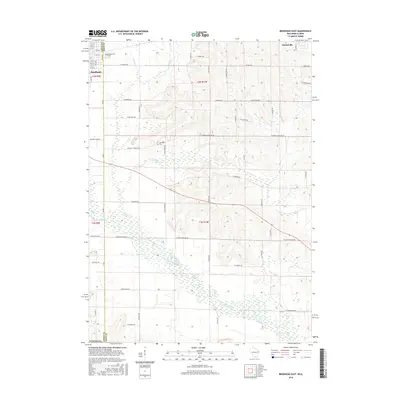
2016 Map of Brodhead East
USGS Topo · Published 2016About this map
The Sugar River meanders across the southern reach of this landscape, carving a wide valley floor marked by extensive wetlands. To the northwest, the city of Brodhead anchors the boundary between Green and Rock counties, while Orfordville sits on the northeastern edge of the survey. The agricultural character of the area is defined by a dense grid of country roads and family-named routes such as Halfway Tree Rd and Schadewalt Rd, connecting isolated farmsteads across the undulating terrain between Taylor Cr and Swan Cr. Genealogists will find local history preserved at Greenwood Cem near the town center and the more secluded Northrup Cem further east, providing a clear record of the rural communities that have long worked this river-fed valley.
Find a feature on this map
33 named features on this map. Tap any name to fly to it.
Don’t see what you’re looking for? This feature index may not catch every label — zoom into the map to look around manually.
Map Details
Editions of this 2016 Brodhead East Map
This is the sole edition of this map. No revisions or reprints were ever made.
Other maps of this area

1891 · Janesville
USGS Topo · 1:62,500

1893 · Janesville
USGS Topo · 1:62,500

1893 · Brodhead
USGS Topo · 1:62,500

1918 · Rockford
USGS Topo · 1:62,500

1932 · Pecatonica
USGS Topo · 1:62,500

1936 · Pecatonica
USGS Topo · 1:62,500

1938 · Rockford
USGS Topo · 1:62,500

1954 · Rockford
USGS Topo · 1:250,000

1955 · Rockford
USGS Topo · 1:250,000

1958 · Rockford
USGS Topo · 1:250,000