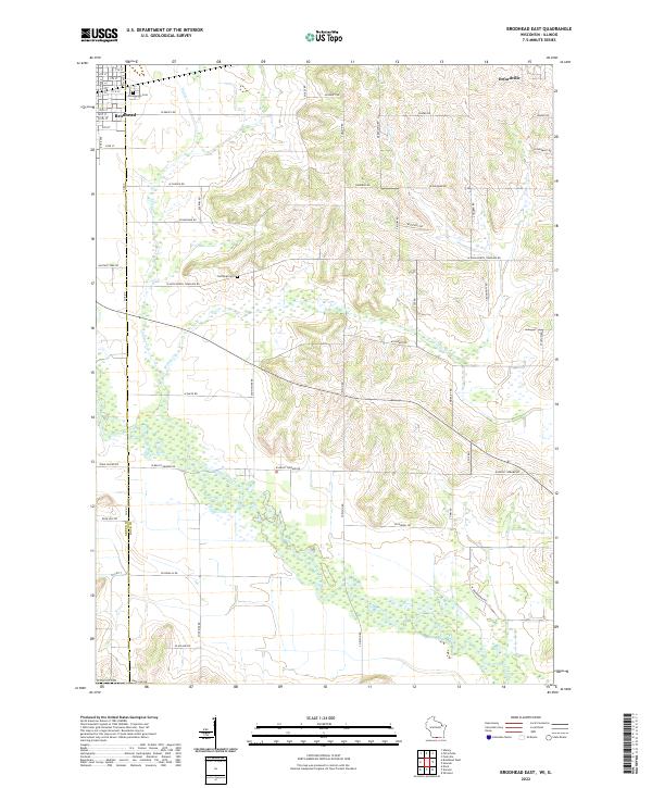
2022 Map of Brodhead East
USGS Topo · Published 2022About this map
The Sugar River and its meandering tributaries, including Willow Cr and Taylor Cr, define the drainage patterns across this borderland between Rock and Green counties. On the northern edge, the residential grids of Brodhead and Orfordville anchor the landscape, while the southern reaches descend toward the State Line Rd marking the Illinois boundary. This modern survey illustrates how long-established rural landmarks like Greenwood Cem and Northrup Cem remain fixed points amidst a patchwork of agricultural lands and section roads. The terrain is a network of named routes such as Halfway Tree Rd and W Beloit Newark Rd, tracing the movement of modern commerce through a region where the watercourses still follow their natural, winding paths through the valley.
Find a feature on this map
44 named features on this map. Tap any name to fly to it.
Don’t see what you’re looking for? This feature index may not catch every label — zoom into the map to look around manually.
Map Details
Editions of this 2022 Brodhead East Map
This is the sole edition of this map. No revisions or reprints were ever made.
Other maps of this area

1891 · Janesville
USGS Topo · 1:62,500

1893 · Janesville
USGS Topo · 1:62,500

1893 · Brodhead
USGS Topo · 1:62,500

1918 · Rockford
USGS Topo · 1:62,500

1932 · Pecatonica
USGS Topo · 1:62,500

1936 · Pecatonica
USGS Topo · 1:62,500

1938 · Rockford
USGS Topo · 1:62,500

1954 · Rockford
USGS Topo · 1:250,000

1955 · Rockford
USGS Topo · 1:250,000

1958 · Rockford
USGS Topo · 1:250,000