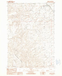
1990 Map of Brogan
USGS Topo · Published 1990About this map
Brogan occupies the northeastern corner of this 1990 survey, situated where Willow Creek enters a broad valley from the north. The settlement is centered around a Po and a Park, with a nearby Cem and Quarry indicating the local infrastructure and industry during this era. To the south and west, the landscape rises dramatically toward the heights of Cottonwood Mountain, which dominates the southwestern portion of the map. This high ground is dissected by an intricate network of drainages including Thorn Creek, Gum Boot Creek, and Poison Creek. The presence of several corrals and camps, such as Boston Horse Camp and Springs Corral, suggests a landscape shaped by ranching and livestock management. This high-desert terrain is further defined by isolated water sources like Buck Spring and the Pole Creek Reservoir, which were essential for sustaining movement through this arid part of Malheur County.
Find a feature on this map
30 named features on this map. Tap any name to fly to it.
Don’t see what you’re looking for? This feature index may not catch every label — zoom into the map to look around manually.
Map Details
Editions of this 1990 Brogan Map
This is the sole edition of this map. No revisions or reprints were ever made.
Other maps of this area

1950 · Jamieson
USGS Topo · 1:62,500

1951 · Huntington
USGS Topo · 1:62,500

1955 · Baker
USGS Topo · 1:250,000

1959 · Baker
USGS Topo · 1:250,000

1964 · Bridgeport
USGS Topo · 1:62,500

1964 · Brogan
USGS Topo · 1:62,500

1980 · Brogan
USGS Topo · 1:100,000
1988 · Birch Creek Meadow
USGS Topo · 1:24,000
1988 · Jamieson
USGS Topo · 1:24,000
1988 · Hope Butte
USGS Topo · 1:24,000