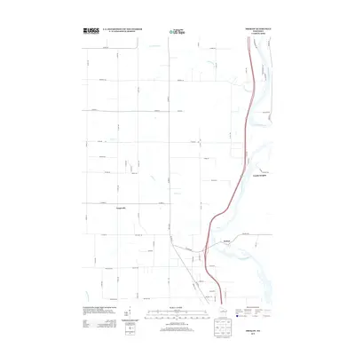
2013 Map of Brokaw
USGS Topo · Published 2013About this map
Wisconsin River frontage and the village of Brokaw dominate the eastern corridor of this Marathon County landscape. The river, fed by tributaries like Silver Creek and County Line Creek, flows southward past the industrial footprint of Brokaw and the settlement of Granite Heights. To the west, the terrain transitions into a grid of agricultural and residential roads, where the community of Taegesville sits at the intersection of several arterial routes including County Highway A and North 60th Avenue. This 2013 survey illustrates the developed transportation network connecting these rural centers to the northern outskirts of Wausau, while the Little Rib River briefly appears in the southwestern corner, marking the drainage patterns of the central Wisconsin woodlands.
Find a feature on this map
56 named features on this map. Tap any name to fly to it.
Don’t see what you’re looking for? This feature index may not catch every label — zoom into the map to look around manually.
Map Details
Editions of this 2013 Brokaw Map
This is the sole edition of this map. No revisions or reprints were ever made.
Other maps of this area

1899 · Wausau
USGS Topo · 1:125,000

1902 · Wausau
USGS Topo · 1:125,000

1902 · Marathon
USGS Topo · 1:125,000

1951 · Merrill
USGS Topo · 1:48,000

1951 · Hamburg
USGS Topo · 1:48,000

1953 · Wausau
USGS Topo · 1:48,000

1953 · Marathon
USGS Topo · 1:48,000

1954 · Iron Mountain
USGS Topo · 1:250,000

1955 · Green Bay
USGS Topo · 1:250,000

1959 · Iron Mountain
USGS Topo · 1:250,000