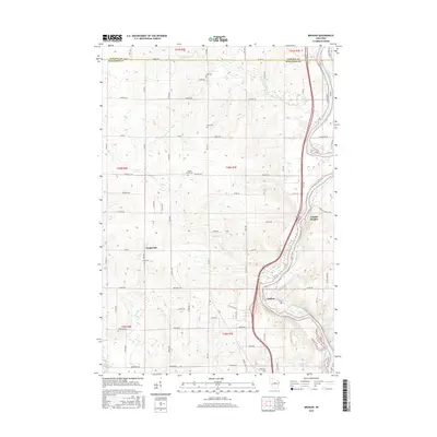
2015 Map of Brokaw
USGS Topo · Published 2015About this map
The Wisconsin River carves through the eastern portion of this Marathon County landscape, serving as a corridor for the riverside settlements of Brokaw and Granite Heights. The terrain transitions from the river valley into a grid of rural township roads and agricultural land, where small community centers like Taegesville persist. This 2015 survey illustrates a well-established rural infrastructure, where local history is anchored by family and community landmarks such as Jehn Cem, Zion Cem, and Maple Grove Cem. The hydrology is defined by the larger river's tributaries, including Silver Cr, County Line Cr, and the Little Rib River, which drain the surrounding woods and fields. The map provides a precise look at the township and range divisions near the Lincoln County border, reflecting the long-standing land-use patterns of central Wisconsin.
Find a feature on this map
72 named features on this map. Tap any name to fly to it.
Don’t see what you’re looking for? This feature index may not catch every label — zoom into the map to look around manually.
Map Details
Editions of this 2015 Brokaw Map
This is the sole edition of this map. No revisions or reprints were ever made.
Other maps of this area

1899 · Wausau
USGS Topo · 1:125,000

1902 · Wausau
USGS Topo · 1:125,000

1902 · Marathon
USGS Topo · 1:125,000

1951 · Merrill
USGS Topo · 1:48,000

1951 · Hamburg
USGS Topo · 1:48,000

1953 · Wausau
USGS Topo · 1:48,000

1953 · Marathon
USGS Topo · 1:48,000

1954 · Iron Mountain
USGS Topo · 1:250,000

1955 · Green Bay
USGS Topo · 1:250,000

1959 · Iron Mountain
USGS Topo · 1:250,000