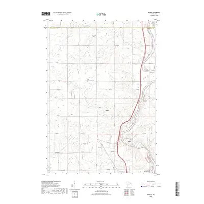
2018 Map of Brokaw
USGS Topo · Published 2018About this map
The Wisconsin River carves through the eastern portion of this Marathon County landscape, serving as a primary corridor for the industrial and residential developments of Brokaw and Granite Heights. In the north, the boundary between Lincoln Co and Marathon Co is marked by County Line Cr, while the rural interior is defined by a network of local roads such as Naugart Dr and Co Rd A. The settlement patterns here reflect a strong community heritage, evidenced by several scattered burial sites including Jehn Cem, Zion Cem, Maple Grove Cem, and Town Cem. Smaller watercourses like Silver Cr wind through the township of Maine, illustrating the drainage patterns that shaped early agriculture and land use before the expansion of northern Wausau reached into these outlying rural areas.
Find a feature on this map
41 named features on this map. Tap any name to fly to it.
Don’t see what you’re looking for? This feature index may not catch every label — zoom into the map to look around manually.
Map Details
Editions of this 2018 Brokaw Map
This is the sole edition of this map. No revisions or reprints were ever made.
Other maps of this area

1899 · Wausau
USGS Topo · 1:125,000

1902 · Wausau
USGS Topo · 1:125,000

1902 · Marathon
USGS Topo · 1:125,000

1951 · Merrill
USGS Topo · 1:48,000

1951 · Hamburg
USGS Topo · 1:48,000

1953 · Wausau
USGS Topo · 1:48,000

1953 · Marathon
USGS Topo · 1:48,000

1954 · Iron Mountain
USGS Topo · 1:250,000

1955 · Green Bay
USGS Topo · 1:250,000

1959 · Iron Mountain
USGS Topo · 1:250,000