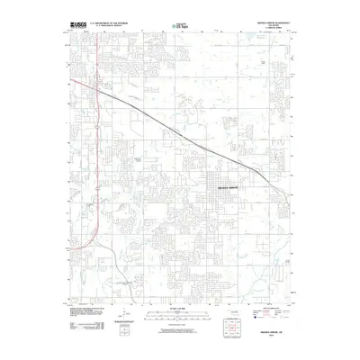
2010 Map of Broken Arrow
USGS Topo · Published 2010About this map
Broken Arrow is depicted here during a period of significant suburban expansion, where residential street grids increasingly overlap former agricultural lands. The landscape is defined by the drainage patterns of Mingo Creek and Haikey Creek, which guide the alignment of major thoroughfares and housing developments. This survey captures a specific moment in the city's aviation and recreation history, featuring the 81st Street Airpark and the specialized Silverwood Ultralight Airport in the southwest. Cultural and community landmarks are prominently established, including the extensive Floral Haven Memorial Gardens and the Lynn Lane Reservoir. The map also preserves the location of Camp Russell on the eastern edge and the curiously named Cotton Field to the north, providing a clear record of how the built environment transitioned from rural plots to a modern municipal layout by the early 21st century.
Find a feature on this map
32 named features on this map. Tap any name to fly to it.
Don’t see what you’re looking for? This feature index may not catch every label — zoom into the map to look around manually.
Map Details
Editions of this 2010 Broken Arrow Map
This is the sole edition of this map. No revisions or reprints were ever made.
Other maps of this area

1896 · Okmulgee
USGS Topo · 1:125,000

1900 · Okmulgee
USGS Topo · 1:125,000

1901 · Claremore
USGS Topo · 1:125,000

1914 · Claremore
USGS Topo · 1:125,000

1916 · Claremore
USGS Topo · 1:125,000

1946 · Fort Smith
USGS Topo · 1:250,000

1952 · Jenks
USGS Topo · 1:24,000

1954 · Tulsa
USGS Topo · 1:250,000

1954 · Tulsa
USGS Topo · 1:24,000

1955 · Mingo
USGS Topo · 1:24,000