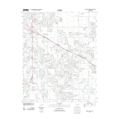
2012 Map of Broken Arrow
USGS Topo · Published 2012About this map
Alsuma and Union anchor the western edge of this suburban landscape during a period of significant infrastructural expansion south of the Lynn Lane Reservoir. The map illustrates a densely gridded residential and commercial corridor defined by the intersection of major transit arteries, including the Creek Tpke N and Muskogee Tpke W. This 2012 survey captures the area's transition into a major regional hub, evidenced by large-scale institutional developments like the Vatterott Coll Tulsa Campus and the extensive Floral Haven Memorial Gardens. Natural drainages such as Mingo Cr and Haikey Cr navigate the suburban blocks, providing a contrast to the engineered geometry of the tollways and the commercial frontage along State Farm Blvd. Local education and service history is noted through several campuses of the Broken Arrow Beauty Coll, situated amidst the evolving neighborhoods.
Find a feature on this map
26 named features on this map. Tap any name to fly to it.
Don’t see what you’re looking for? This feature index may not catch every label — zoom into the map to look around manually.
Map Details
Editions of this 2012 Broken Arrow Map
This is the sole edition of this map. No revisions or reprints were ever made.
Other maps of this area

1896 · Okmulgee
USGS Topo · 1:125,000

1900 · Okmulgee
USGS Topo · 1:125,000

1901 · Claremore
USGS Topo · 1:125,000

1914 · Claremore
USGS Topo · 1:125,000

1916 · Claremore
USGS Topo · 1:125,000

1946 · Fort Smith
USGS Topo · 1:250,000

1952 · Jenks
USGS Topo · 1:24,000

1954 · Tulsa
USGS Topo · 1:250,000

1954 · Tulsa
USGS Topo · 1:24,000

1955 · Mingo
USGS Topo · 1:24,000