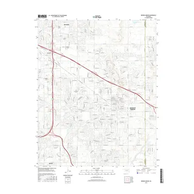
2016 Map of Broken Arrow
USGS Topo · Published 2016About this map
Broken Arrow and the southeastern reaches of Tulsa define this modern landscape where residential expansion meets established local history. The map highlights the dense street grid connecting neighborhoods across the Tulsa Co Wagoner Co line, illustrating the region's growth into a contiguous suburban corridor. Notable landmarks include the extensive Floral Haven Memorial Gardens and the Park Grove Cem, alongside educational centers like the Vatterott Coll Tulsa Campus. Natural drainage is managed by a network of waterways including Mingo Cr, Haikey Cr, and Spunky Cr, which wind through the developed areas. Major transit arteries such as the E Broken Arrow Expy and Creek Tpke facilitate movement between Alsuma, Union, and Bixby, while traces of earlier infrastructure remain visible in the alignment of Old Hwy 51.
Find a feature on this map
27 named features on this map. Tap any name to fly to it.
Don’t see what you’re looking for? This feature index may not catch every label — zoom into the map to look around manually.
Map Details
Editions of this 2016 Broken Arrow Map
This is the sole edition of this map. No revisions or reprints were ever made.
Other maps of this area

1896 · Okmulgee
USGS Topo · 1:125,000

1900 · Okmulgee
USGS Topo · 1:125,000

1901 · Claremore
USGS Topo · 1:125,000

1914 · Claremore
USGS Topo · 1:125,000

1916 · Claremore
USGS Topo · 1:125,000

1946 · Fort Smith
USGS Topo · 1:250,000

1952 · Jenks
USGS Topo · 1:24,000

1954 · Tulsa
USGS Topo · 1:250,000

1954 · Tulsa
USGS Topo · 1:24,000

1955 · Mingo
USGS Topo · 1:24,000