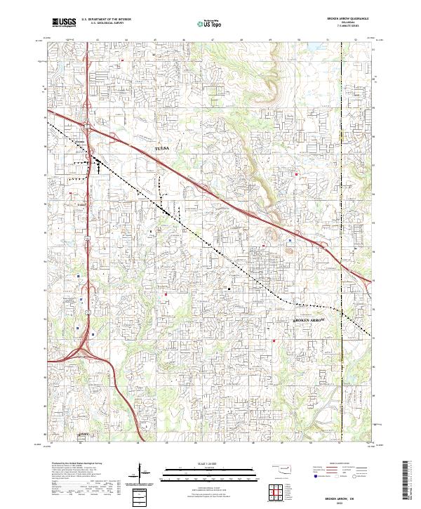
2022 Map of Broken Arrow
USGS Topo · Published 2022About this map
Broken Arrow and the southeastern reaches of Tulsa define this modern landscape at the boundary of Tulsa County and Wagoner County. The mapping illustrates the dense suburban infrastructure of the early 2020s, characterized by a strictly organized grid of arterial roads such as E 71st St S and E 111th St S. Notable educational and civic landmarks are prominently featured, including the Tulsa Community College Southeast Campus and the Tulsa Tech Center.
Find a feature on this map
45 named features on this map. Tap any name to fly to it.
Don’t see what you’re looking for? This feature index may not catch every label — zoom into the map to look around manually.
Map Details
Editions of this 2022 Broken Arrow Map
This is the sole edition of this map. No revisions or reprints were ever made.
Other maps of this area

1896 · Okmulgee
USGS Topo · 1:125,000

1900 · Okmulgee
USGS Topo · 1:125,000

1901 · Claremore
USGS Topo · 1:125,000

1914 · Claremore
USGS Topo · 1:125,000

1916 · Claremore
USGS Topo · 1:125,000

1946 · Fort Smith
USGS Topo · 1:250,000

1952 · Jenks
USGS Topo · 1:24,000

1954 · Tulsa
USGS Topo · 1:250,000

1954 · Tulsa
USGS Topo · 1:24,000

1955 · Mingo
USGS Topo · 1:24,000