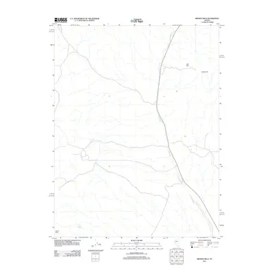
2011 Map of Broken Hills
USGS Topo · Published 2011About this map
Broken Hills sits at the heart of this high-desert landscape in Mineral County, Nevada, reflecting a region defined by its sparse water sources and topographic landmarks. The map traces the intermittent course of Gabbs Wash as it moves through the terrain, a critical drainage feature for the area. Isolated water points like Jack O'Connor Spring indicate the essential, site-specific resources necessary for survival and settlement in this arid environment. The landscape is punctuated by prominent natural elevations, including the peak of Mount Anna in the south and the distinct formation of Ball Rock to the northeast. This 2011 survey captures the distribution of these named features and the simple network of roads that connect the namesake settlement to the surrounding basin and range country.
Find a feature on this map
5 named features on this map. Tap any name to fly to it.
Don’t see what you’re looking for? This feature index may not catch every label — zoom into the map to look around manually.
Map Details
Editions of this 2011 Broken Hills Map
This is the sole edition of this map. No revisions or reprints were ever made.
Other maps of this area

1907 · Tonopah
USGS Topo · 1:250,000

1908 · Tonopah
USGS Topo · 1:250,000

1908 · Carson Sink
USGS Topo · 1:250,000

1909 · Hawthorne
USGS Topo · 1:250,000

1910 · Carson Sink
USGS Topo · 1:250,000

1911 · Hawthorne
USGS Topo · 1:250,000

1915 · Hawthorne
USGS Topo · 1:250,000

1948 · Paradise Peak
USGS Topo · 1:62,500

1948 · Walker Lake
USGS Topo · 1:250,000

1950 · Paradise Peak
USGS Topo · 1:62,500