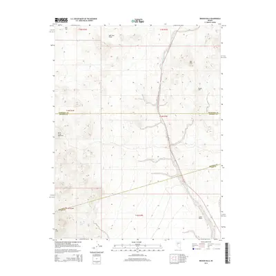
2014 Map of Broken Hills
USGS Topo · Published 2014About this map
Broken Hills sits at the high-desert intersection of Churchill, Mineral, and Nye Counties, serving as a focal point for this 2014 survey. The landscape is defined by the arid basin-and-range topography typical of central Nevada, with the Monte Cristo Mountains and the West Gate Range framing the drainage systems of the region. Gabbs Wash carves a prominent path through the center of the sheet, leading down toward the broad expanse of Gabbs Valley in the south.
Find a feature on this map
18 named features on this map. Tap any name to fly to it.
Don’t see what you’re looking for? This feature index may not catch every label — zoom into the map to look around manually.
Map Details
Editions of this 2014 Broken Hills Map
This is the sole edition of this map. No revisions or reprints were ever made.
Other maps of this area

1907 · Tonopah
USGS Topo · 1:250,000

1908 · Tonopah
USGS Topo · 1:250,000

1908 · Carson Sink
USGS Topo · 1:250,000

1909 · Hawthorne
USGS Topo · 1:250,000

1910 · Carson Sink
USGS Topo · 1:250,000

1911 · Hawthorne
USGS Topo · 1:250,000

1915 · Hawthorne
USGS Topo · 1:250,000

1948 · Paradise Peak
USGS Topo · 1:62,500

1948 · Walker Lake
USGS Topo · 1:250,000

1950 · Paradise Peak
USGS Topo · 1:62,500