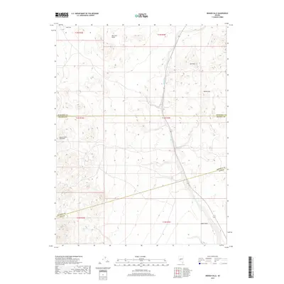
2018 Map of Broken Hills
USGS Topo · Published 2018About this map
Broken Hills sits at the intersection of several county lines in this high-desert region of Nevada, where the West Gate Range meets the northern extent of the Monte Cristo Mountains. The landscape is defined by its arid basins and volcanic terrain, notably Gabbs Valley and the broad expanse of Bell Flat to the northwest. Modern state route 361 follows the natural corridor carved by Gabbs Wash, providing a vital transit link through the basin. Local water sources like Jack O'Connor Spring reflect the sparse but essential landmarks necessary for navigation and survival in this environment. The map details the complex boundaries where Churchill, Mineral, and Nye counties converge, illustrating how topography like Ball Rock dictates the administrative divisions of this remote interior.
Find a feature on this map
17 named features on this map. Tap any name to fly to it.
Don’t see what you’re looking for? This feature index may not catch every label — zoom into the map to look around manually.
Map Details
Editions of this 2018 Broken Hills Map
This is the sole edition of this map. No revisions or reprints were ever made.
Other maps of this area

1907 · Tonopah
USGS Topo · 1:250,000

1908 · Tonopah
USGS Topo · 1:250,000

1908 · Carson Sink
USGS Topo · 1:250,000

1909 · Hawthorne
USGS Topo · 1:250,000

1910 · Carson Sink
USGS Topo · 1:250,000

1911 · Hawthorne
USGS Topo · 1:250,000

1915 · Hawthorne
USGS Topo · 1:250,000

1948 · Paradise Peak
USGS Topo · 1:62,500

1948 · Walker Lake
USGS Topo · 1:250,000

1950 · Paradise Peak
USGS Topo · 1:62,500